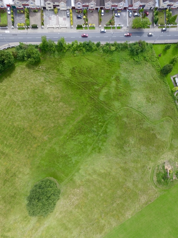
 Graham came in today and took a series of aerial photos using his Phantom 3 quadcopter. The mission: to get a first look of our wetland from the air.
As you can see in the example above, the quality of images is brilliant. The Bishop’s Field looks so vividly green from above and some of the shots really show the beauty of the Corbally area. We are able to see from these first images that there is an absence of tall grasses from the wetland area, hence the irregular green shade. The shape of the wetland depends on both the level of rainfall and the relief of the land. Since the rainfall is irregular during the Winter months, the wetland can grow or shrink at different times. It is interesting to note at this stage that the wetland may not correspond exactly to the darker green area on the photo as one would assume. Does the wetland take up a much larger area than this green shape when at its peak? This is where our mapping of the wetland area will be key and provide some answers. We intend to map the area so that we have an idea of the shape of the land. We can then predict which areas are lowest and which are high and less likely to flood. We are thinking of using a grid system of poles so that we can both get a ‘level’ on the height of the land and also measure the water depth when the area starts to flood. The children will be exposed to a great level of hands on Science as the project starts to progress. Along with groundwork and mapping we hope to take images from the exact same viewpoint in the sky every month to build up a visual gallery of the Bishop’s Field as it floods in the Winter and recedes (hopefully!) in the Spring. Thanks to Graham for agreeing to be part of the project, for his idea to keep this blog to document our project and of course in the coming months he will be our eye in the sky with his drone so to speak! More to come in August. Neil Foley
0 Comments
|
Blog Archives
April 2017
From the air...
|
|
|
|